
Walk the Tamarac Street Directory by Address
A useful street-by-street search starts with the situs address, the place where the parcel physically sits. Broward County Property Appraiser records establish the current assessed parcel and named owner. The map supplies spatial context, while Broward County Records, Taxes and Treasury supplies recorded ownership changes. Tamarac permits can date work at the site. A public voter extract or an older reverse directory may add residence evidence, but neither is a complete roll of a household.
- Enter the property address in BCPA Record Search and save the folio, legal description, owner, mailing address, and latest sale reference.
- Open BCPA Maps and Aerials, select the parcel, then pan along both sides of the Tamarac road rather than trusting house-number order.
- Carry the parcel ID or deed instrument into Broward Official Records, because a deed may not be indexed by street text.
- Search Tamarac Click2Gov by street number and name to date permits, their status, contractor, and inspection events.
- Use a lawful Broward voter-data request or an address-oriented directory only as added evidence, while accounting for omissions and protected addresses.
This order keeps the by-address search tied to a stable parcel key. It also prevents a mailing address, owner name, or listed phone subscriber from being mistaken for every person at the site.
BCPA Fields for the Tamarac Street Directory
The BCPA property search accepts several routes into the same assessment roll. Address is the natural start for a street search, but folio is the strongest exact key once found. The parcel card can include owner and mailing address, property address, municipality, property use, legal description, values, exemptions, sales references, year built, building details, and map links.
| BCPA control | Input style | Required? | Street-directory use |
|---|---|---|---|
| Owner Name | Text | No | Find parcels associated with a spelled name |
| Property Address | Text | No | Search the situs location and include a unit with care |
| Parcel/Folio | Text | No | Return to one exact parcel across systems |
| Map search | Address or parcel autocomplete | No | Center and select a mapped parcel |
| Pan/Zoom | Map controls | No | Move along a Tamarac street or around a block |
| Layers/Basemap/Aerial | Toggles | No | Compare context and visible development |
| Identify/select parcel | Map click | No | Open attributes and the linked property card |
The source image below comes from the official BCPA parcel map.

The map view makes the folio and parcel boundary the bridge between an entered Tamarac address and the matching property record.
Map Curves in the Tamarac Street Directory
Tamarac grew through separated planned tracts, with canals, golf-oriented subdivisions, curves, loops, courts, and condominium parcels. Consecutive house numbers therefore do not always identify the parcels that actually touch. BCPA Maps and Aerials lets a reader pan, zoom, click a polygon, change the base map, and open linked parcel detail. Broward GeoHub adds county GIS context and annexation resources.
The official Broward GeoHub is a second map source for understanding boundaries and district context.

Use mapped parcel geometry as a research guide, not a survey, and save the folio for each parcel selected.
- Situs address
- The physical location of the land or improvement, distinct from where the tax notice is mailed.
- Parcel or folio
- Broward's stable identifier for one assessed property.
- Plat
- A recorded map that sets out a subdivision, lots, blocks, and related lines.
- Criss-cross directory
- An older directory section arranged by street and house number rather than by surname.
What the Tamarac Street Directory Can Link
No single Tamarac record set names every occupant. The sound approach is to state what each custodian proves and what it leaves open. Ownership, parcel shape, recorded transfers, permit work, and voter registration are separate evidence layers.
| Address record | Official keeper | Evidence supplied | How to reach it |
|---|---|---|---|
| Assessment roll | BCPA | Owner, mailing and situs addresses, folio, legal description, exemptions, improvements | Free web search and parcel card |
| Parcel GIS | BCPA and Broward GeoHub | Boundaries, aerial context, adjacent parcels, and districts | Free online maps |
| Deeds and mortgages | Broward RTT | Grantor, grantee, dates, consideration, and legal description | Free index/images; Search and Copy fallback |
| Public voter extract | Broward Supervisor of Elections | Permitted registration fields by residence address, with exclusions | Form, email, NextRequest, mail, or office channel; fees may apply |
| Building permits | City of Tamarac | Project, site, contractor, status, and inspections | Free Click2Gov; city request fallback |
| Reverse directory | Broward County Library | Listed subscriber at an address for a covered year | Main Library database or microfiche with staff help |
The folio ties the parcel card to mapped land and may appear in recorded-document fields. An instrument or book/page reaches the deed image. Street text connects permits and address-oriented listings, but spelling, direction, suffix, unit, and postal-city variations should be tested.
Carry a Folio Through the Tamarac Street Directory
Broward Official Records does not index every deed by street address or full legal-description text. That makes the BCPA folio, present owner, sales reference, and legal description crucial. The Official Records Search offers party name and role, book/page, document type, instrument number, case number, consideration, recorded date, simple search, and parcel ID routes. Its result fields can include status, party role, direct and indirect names, record date, document type, book, page, legal information, and instrument.
A blue indexed name can lead to detail and an image. The image may add execution date, notary, return-to address, and the full legal description. Search spelling variants, and do not read a deed as an occupant list. Online viewing and copying are free; eligible modern documents may be electronically certified, while counter certification is available at Room 114 in the Broward Governmental Center.
The Minute-Level Broward Cutoff Behind Tamarac Streets
The recorder chronology is unusually exact. Fully searchable modern documents start July 7, 1977 at 1:47 p.m. Limited electronic material runs from March 9, 1972 at 11:28 a.m. through July 7, 1977 at 1:46 p.m. Plats and maps are searchable regardless of date. Earlier books require Broward RTT Search and Copy Services rather than a guess that an empty web result means no deed exists.
This contrast matters when a Tamarac by-street search follows a parcel backward. Modern owner-name searching can build a chain after the full-index start. Within the limited span, use instrument, book/page, and recorded date. Before that span, contact Search and Copy Services. The Recording Office is at 115 S. Andrews Avenue, Room 114, Fort Lauderdale, open 8:30 a.m. to 5 p.m.; the phone is 954-831-4000 or 311.
Tamarac Permits Add Dates, Not Residents
The City of Tamarac Click2Gov building permit search can be run by application number, address, parcel components, or name. Address mode separates street number, optional direction, street name, match style, and suffix. Results can expose permit number and type, site address, status, contractor, value, and inspection events. Those fields help date a new roof, addition, or other physical change, but they do not prove who slept at the site.
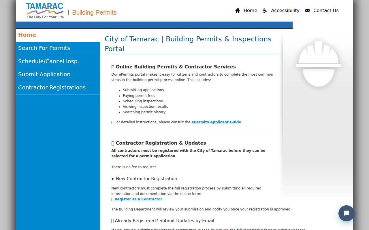
The linked image shows the official Tamarac permit portal used to add municipal project dates to the street chain.
If the portal lacks the needed result, request identifiable permit or inspection records by address, parcel, department, and date range from the City Clerk. Code Compliance can provide a separate property-history route, subject to exemptions.
The city's Code Compliance service is the official follow-up for an address-specific compliance history that the permit results do not answer.
This route may identify a case, property, owner, or responsible party, but protected complaint details and personal information can be withheld.
Voter Evidence in a Tamarac Street Directory
Broward's public-facing voter lookup is mainly for a person to verify personal registration, not for unrestricted street browsing. A lawful public extract may include permitted name, residence address, party, registration status and date, precinct, and participation history, never ballot choices. It will omit nonvoters and protected addresses, while inactive or cancelled entries need context.
Request channels include the Registered Voter List Data Request form, publicrecords@browardvotes.gov, NextRequest, mail, and office delivery. The published price list states a $20 database search and an optional $6 USB; files over 10 MB use Dropbox. Headquarters is at 4650 NW 21st Avenue, Fort Lauderdale, open weekdays 9 a.m. to 5 p.m., at 954-357-VOTE. Ask for defined geography, fields, date, and a data dictionary.
Note: Vote-by-mail request data is restricted and must remain separate from an ordinary public registration extract.
Old Tamarac Addresses Need Metro Directories
Tamarac incorporated in 1963, so its address history is a Broward and Fort Lauderdale metropolitan question. Broward Main Library lists Fort Lauderdale Suburban directories from 1975 through 1986, the most promising run for Tamarac, though each volume's geographic preface must be checked. Older telephone directories are held on microfiche. A reverse or Street and Avenue Guide can turn a house number into the listed subscriber for that year.
Directory gaps can mean nonlisting, a missed canvass, a billed party under another name, or geographic coverage limits. They do not prove a move. Earlier Tamarac land may appear under a subdivision, unincorporated Broward, or township, range, and section. The historical collections and entry conventions are covered more fully in the Tamarac city directory.
Who the Tamarac Street Directory Will Miss
A tax-roll owner is not necessarily a Tamarac resident, and even a homestead flag is only evidence of a claimed primary residence, not a household roster. A different mailing address may suggest an owner receives notices elsewhere, but it does not name an occupant. The roll normally misses renters and other household members. Reverse directories miss unlisted people and may name only the billed subscriber. Voter data misses nonvoters and protected participants. Driver and utility customer data are not public address directories.
Lawful use. Use Tamarac address records for lawful personal research, and never use a result to stalk, harass, intimidate, or harm someone.
A careful by-address directory therefore labels each result by its real role: owner, grantee, applicant, listed subscriber, or registered voter. When evidence conflicts, return to the official image, parcel key, date, and custodian instead of merging people into one assumed household.